Storm Babet: Yellow severe weather warnings for wind and rain for Scotland as more flooding expected
Yellow severe weather warnings for wind and rain will be in place for much of this week with the arrival of Storm Babet, with more flooding expected in Scotland.
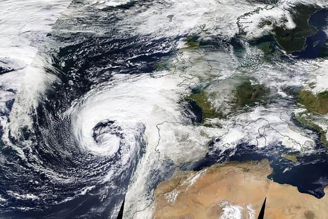
The second named storm of the season will last from Wednesday until Saturday, the Met Office said, and is expected to cause flooding, power cuts and travel disruption.
Advertisement
Hide AdAdvertisement
Hide AdYellow warnings have been issued across the four days for a vast swathe of the UK, covering much of Scotland, eastern Northern Ireland, the north east of England, Yorkshire, the East Midlands and East Anglia.
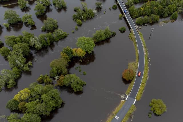

As much as 150 to 200mm of rain is expected to fall on central and eastern areas of Scotland. There is a possibility of 70mph gale-force winds affecting northern parts of the UK, forecasters warned.
Communities in Aviemore, Highlands, Argyll and Bute, and Perthshire were badly impacted at the start of this month, with weather so bad it was compared to the Beast from the East in 2018.
Rain is expected to affect similar areas in Argyll and Bute, Dumfries and Galloway, Tayside, Dundee, and Angus and Grampian – and winds could reach 60mph in northern Scotland.
The Met Office and Scottish Environment Protection Agency (Sepa) are already issuing warnings, but said those may change with the forecast.
Partners and responder agencies were alerted to the potential impacts on Sunday through Sepa’s flood guidance statement.
David Morgan, flood duty manager for Sepa, said: “Storm Babet will bring heavy rain and high winds across Scotland from Wednesday evening, starting in the South West before moving across to the North East through Thursday and into the weekend.
“Impacts from surface water and rivers are likely, and with catchments saturated from recent heavy rain and flooding, we’re urging people to be prepared for potential flooding.
Advertisement
Hide AdAdvertisement
Hide Ad“There is also concern that surface water flooding may be exacerbated by debris blocking drainage, culverts, etc. as a result of the high winds.
“Flood alerts and warnings will be issued as required, and we continue to work with the Met Office to monitor the situation 24/7.
“People can check our flood updates for all the latest information and the three-day Scottish flood forecast to see what conditions are expected further ahead.
“If you live or work in an area that could be affected, consider any steps you need to take now to be prepared and stay safe, and to take extra care if you need to travel.
“If you have not already signed up to Floodline, you can do so now to receive free updates for where you live, or travel through, directly to your phone. Follow Sepa’s social media, especially @SEPAflood on X for the latest information.”
Met Office chief meteorologist Steven Keates said: “Heavy and persistent rain will fall onto already saturated ground bringing a risk of flooding. It is important to stay up to date with warnings from your local flood warning agency as well as the local authorities.
“For Scotland, this rain will be fairly heavy and persistent through much of the second half of the week and into the early part of the weekend. As well as heavy rain, Storm Babet will bring some very strong winds and large waves near some eastern coasts too.
“Gusts in excess of 60mph are possible in eastern and northern Scotland from Thursday. It is likely Met Office warnings will be updated through the week.”
Advertisement
Hide AdAdvertisement
Hide AdScotland typically receives 168mm of rainfall in October, but the country will receive more than this amount in the span of a few days.
The heavy rain may also cause “fast-flowing and deep floodwater” that could pose a “danger to life”, and there is also a chance of essential services like gas, water and mobile phone signals being disrupted.
Parts of England can expect more than 100mm of rainfall during the week with some isolated areas facing up to 150mm.
Stephen Dixon, a Met Office spokesman, said: “A disruptive period of weather is on the way. There’s some high totals [of rain] which have the potential to disrupt travel plans … possibility of power cuts as well as the obvious risk of flooding.
“As you look at Wednesday, the first pulse of rain is looking to particularly influence Northern Ireland, Wales and the southwest of England, and into Thursday.
“But it’s as you move from Thursday and into the week that shift very much focuses more towards central and eastern Scotland, but also some central and eastern areas of England as well.”
The Royal National Lifeboat Institution has urged the public to exercise “extreme caution,” particularly along exposed cliffs, seafronts and piers.
Comments
Want to join the conversation? Please or to comment on this article.